
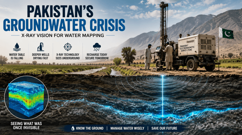
Inside Pakistan’s Groundwater Crisis
Pakistan is going through an extreme groundwater crisis that is hidden, and unfortunately, no one can map it. Scientists have invented an ‘X-Ray Vision’ for water mapping.
The dry mountains surrounding Quetta and beneath the wheat fields of Punjab. Pakistan is on the verge of exhausting its water reserves, which sustain the lives of 0.25 billion people.
The article centers on a survey by scientists from Denmark aimed at changing the current state of the system.
Pakistan is fighting a battle daily that most of the people are unable to notice. It doesn’t have any frontline, no smoke, and no coverage on the news channels because the battle is 100-200 meters under the ground, where the water table is silently shrinking.
Nobody can see aquifer depletion, but we can clearly see its impacts: a tube well that is drilled deeper than before, a borehole that is drying without a warning, a farmer who has stopped asking why. This is the story of an unseen problem that has been unnoticeable for decades.
Danish geophysists that have made a machine like an X-ray machine and brought it to Pakistan to see what years of speculation.
SURFACE: A Country Built On Water That Nobody Can See
Pakistan is fourth in line of water harnessing, behind only China, America, and India. Most of the water under the ground was never mapped. 90% of Pakistan’s daily water consumption and around 60% of irrigation, which supports the agricultural economy, is from groundwater.
In 1950, average water availability per human was around 5000 cubic meters. But according to the latest geophysical survey of 2023, the water availability has crashed to 930 cubic metres, which threshold economists are naming it as ‘absolute water scarcity’.
In 1964, the Pakistan Council of Research in Water Resources (PCRWR) was established, with regional offices in Quetta, Lahore, and Gilgit. But they didn’t have the technology that could show the present state of water underground.
The X-Ray Machine For The Earth
Transient Electromagnetic Surveying (TEM) is the basic tool for this technology. It is a method that was operated by very few geological experts.
A group of Hydrogeophysics from Aarhus University and a firm from Aarhus company both worked together for years to automate the process. Now the process can be conducted by anyone without a geophysical background.
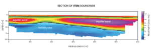
The instrument doesn’t detect water directly; instead, it helps understand the different layers of the Earth and distinguish clay from gravel and sand. It detects the electrical signs of the ground down to 100-200 metres.
Research teams compare it to a CT Scan; a doctor doesn’t need to open up a patient to look for the disease, just like technicians don’t need to drill into the ground to see what’s under it.
This technology, alongside 40 years of satellite data, is used to analyze rainfall and flooding patterns and to predict water recharge under the ground, which means how many years a well might dry.
It Is Not About Finding Water, It’s About Putting It Back
In response to the water crisis, people start to drill deeper and faster, but the real problem is water recharge, which means finding a ground or surface where water can be sent back to replace what is being pulled out.
Monsoon floods are always considered devastating, but can be helpful if a small volume of floodwater is captured before it runs into the rivers. The flood water can be a groundwater refill instead of a threat.
In Ethiopia, the same group of Aarhus has tested small low-cost barriers that run from high to low ground. It is built like a rice paddy that slows the water, layer by layer, so that it soaks into the surface instead of flowing. It increases the moisture of the soil and cuts erosion. This method was created for the areas where constructing dams was nearly impossible, exactly for the most of the areas of Pakistan.
The Underground Numbers
Rooftop rain harvesting can capture rain falling on the roofs of the building for domestic use or can also be used for water recharge purposes. This became compulsory because it was necessary to fight against aquifer depletion.
In March 2026, the Capital Development Authority (CDA) made it mandatory for the property owners to install rooftop harvesting systems in their buildings, and fines are fixed for those who fail to comply by the end of September.
The Technology Was Already Present, Just Not Here
TEM surveying technology has been used in the USA, Europe, and Canada for decades for groundwater mapping. The only thing new about this is that it has reached countries like Kenya, Ethiopia, and India, and therefore, the researchers have to make it cheaper to be available for the governments of underdeveloped countries and simple enough to be operated by local workers without geology degrees.
It is very common in the history of technology transfer that for many years, developed countries keep using the tools and then reach the underdeveloped countries that kept drilling blindly.
Aquifer: The Lack Of Funding
According to teams of researchers, Pakistan has the political will to use this technology, but what Pakistan lacks is sufficient funding. Different countries are trying to close the funding gap in Pakistan.
South Korea is funding the network of automated groundwater monitoring in the capital and Sindh. Korea International Corporation Agency (KOICA) is collaborating with Pakistan Council of Research in Water Resources (PCRWR) for the funding of millions to initiate the project to target depleted aquifers.
Britain’s Foreign, Commonwealth and Development Office (FCDO) is focusing on the UK-Pakistan climate resilience framework, funding around 35 million euros on the ‘Green Compact’ and 90 million euros on the UK-IFC climate investment fund for Pakistan (CIFPAK).
The main focuses are: Climate-smart agriculture. Sustainable water management. Climate resilience infrastructure. Renewable energy. Green finance and blended finance solution.
On the other hand, Denmark’s embassy in Pakistan is also driving science and green diplomacy by targeting climate action, Healthcare innovations, and water management.
According to The Diplomatic Insight reports, ‘The Ambassador of Denmark to Pakistan, Maja Mortensen, met with Federal Minister for Climate Change and Environmental Coordination, Dr. Musadik Malik, to discuss deepening ties in climate action and science diplomacy’.
Meanwhile, the groundwater table is continuously going down. The crisis cannot be ended by this single survey technology until the surface has already been mapped to send water back. Researchers explain the crises;
“One brick, not the whole building”.